Где искать: по сайтам Запорожской области, статьи, видео ролики
пример: покупка автомобиля в Запорожье
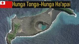
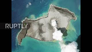
Tonga: Satellite images show Hunga Tonga island before and during eruption *STILLS*
 У вашего броузера проблема в совместимости с HTML5
Follow us on Telegram:
https://t.me/s/ruptlynews
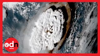
Mandatory credit: Planet Labs PBC
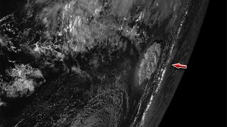
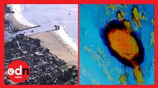
Satellite images showed the Hunga Tonga island before, during and after eruptions of the Hunga Tonga-Hunga Ha’apai, in the oceanic nation of Tonga over recent months.
The eruption caused a tsunami in Tonga and rising water levels on the shores of surrounding nations as far afield as New Zealand and the US.
The capital of Tonga, Nuku’alofa, suffered considerable damage, New Zealand Prime Minister Jacinda Ardern confirmed. No deaths or injuries have yet been reported.
#Tonga #TongaEruption #HungaTonga
Video ID: 20220117-049
Video on Demand: https://ruptly.tv/videos/20220117-049
Contact: [email protected]
Twitter: http://twitter.com/Ruptly
Facebook: http://www.facebook.com/Ruptly