















Где искать: по сайтам Запорожской области, статьи, видео ролики
пример: покупка автомобиля в Запорожье
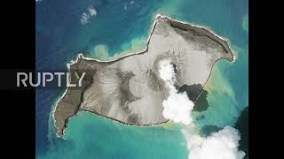
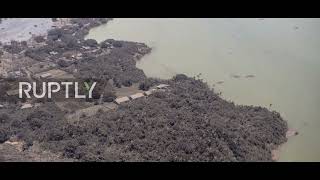
Tonga: Before and after satellite photos show impact of eruption *STILLS*
 У вашего броузера проблема в совместимости с HTML5
Follow us on Telegram:
https://t.me/s/ruptlynews
Mandatory Credit: Satellite image ©2022 Maxar Technologies
The scale of damage caused by an eruption of an underwater volcano can be seen through satellite images of Tonga this Tuesday, as the island remains cut off from communications.
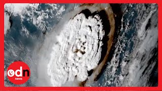
The images show parts of the island with a thick plume of smoke coming out of the volcano, as well as images after the eruption which show destroyed homes covered in thick black ash.
The eruption which occurred on January 15th was the biggest recorded anywhere on the planet in the last 30 years according to scientists, which sent ash and steam up to 20 kilometers (12.4 miles) into the atmosphere.
The scale of the damage remains unclear due to limited communications between the islands and the rest of the world.
Tonga is a country composed of 170 South Pacific islands with a population of 100,000 people.
#Tonga #eruption
Video ID: 20220118-007
Video on Demand: https://ruptly.tv/videos/20220118-007
Contact: [email protected]
Twitter: http://twitter.com/Ruptly
Facebook: http://www.facebook.com/Ruptly